Regulation and Compliance
enable more Efficient governance with high-frequency imagery
Government entities are required to manage and monitor significant geographic regions for a range of purposes. The use of dedicated Earth Observation applications and platforms that can operationalise content from a range of satellite programs can enable departments to adopt a rapid, data driven approach to operations.
Earth observations helps governments manage:
- Forests, natural resources and agriculture
- Report and monitor infrastructure growth and urbanisation
- React to disasters quickly
- Monitor industry activity
Protect and manage natural habitats
The effects of pollution, land-use change and exploitation of natural resources are having a noticeable impact on forests, wetlands and other ecosystems. However, with Earth Observations, cities and governments have a tool to better manage and protect the environment around them.
With high-frequency imagery, governments can:
- Monitor the health of lakes, rivers and reservoirs
- Measure forest conditions, detect illegal deforestation and vegetation health
- Analyse wildlife habitats and land use patterns to inform regulations
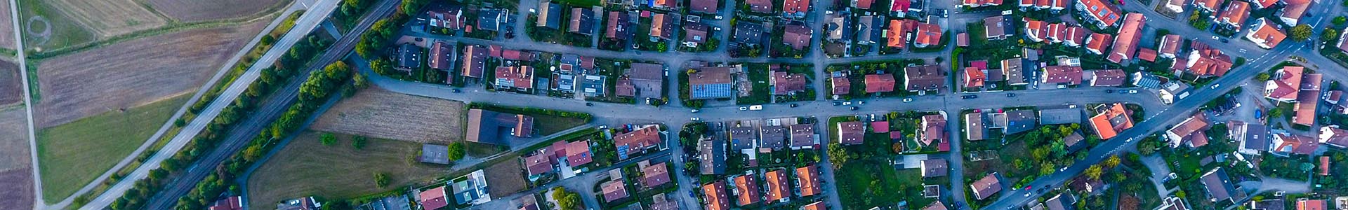
Plan for infrastructure development and urbanisation
Data and content from multiple Earth Observation tools can be integrated with GIS tools to make it simple to map new developments and dynamic ground conditions. EO Data Science through their parent company, NGIS, has a successful history of creating EO and GIS solutions for government infrastructure projects.
Integrated solutions can help governments:
- Monitor new transport infrastructure and construction developments
- Keep track of urban sprawl, city growth and human activity impact
- Ensure regulatory compliance of urban, vegetative and geological sites of interest
React to natural disasters when they happen
Help first responders, governments and aid agencies process and respond to natural disasters through the availability of daily imagery.
- View damage in affected areas and plan evacuations with regularly updated imagery
- Analyse before and after photos to assess damage and contribute to rebuilding efforts
- Easily detect change and deploy on-the-ground resources safely
let's
talk about your compliance project
EO Data Science loves to look at the world from space to answer questions about our planet, but we can also help you get the information you need to transform your business or reach your organisational goals. Get in touch with us to collaborate on your next project!
Get in touch
Learn More
Quicklinks
Our office
Eastpoint Plaza, Suite 5.01, Level 5, 233 Adelaide Terrace, Perth WA 6000, Australia